Today I'm visting right here at home.
One of the things that people love to talk about (complain about, nag about, you name it) is the weather. Everyone has it, of course. And this spring, it's been a nightmare to many places in the United States.
Rochester had the wettest April on record this year, and May hasn't been a great deal more fun. But we're tough, we are and we keep going. And thanking our lucky stars that all we have to deal with is ice storms, blizzards, cold snaps and the occasional humid thundery summer. Yes, we get tornado action, but nothing like the Midwest.
With that said, I thought it might be fun (I have a VERY strange sense of humor) to take a look at wetness around Rochester.
The Genesee River runs right through Rochester on its way to Lake Ontario. Lake Ontario is the smallest (I kid you not) of the five Great Lakes (Quiz: Name 'em! Can't? Remember the acronym: HOMES: Huron, Ontario, Michigan, Erie, and Superior. The biggest? Superior: it's 350 miles long. The shallowest? Erie: which is a woeful thing when the winter winds begin to blow across it.)
Lake Ontario is only 193 miles long and 53 miles wide at its widest point. Lake Erie is 210 miles by 57 miles. Lake Michigan is 307 miles long and 118 miles at its widest. Lake Huron is 206 miles long by 152 miles wide, but has the longest shore length (Quiz: Why?) Lake Superior is 350 miles long by 160 miles wide.
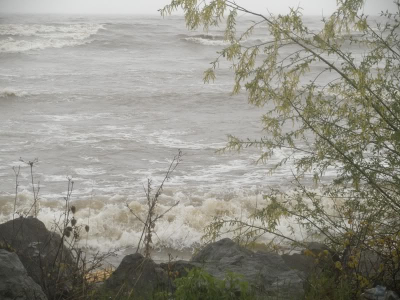
This spring, the effects of the winds and rains have been moderately spectacular. Lets start with Cranberry Pond on a very windy day.

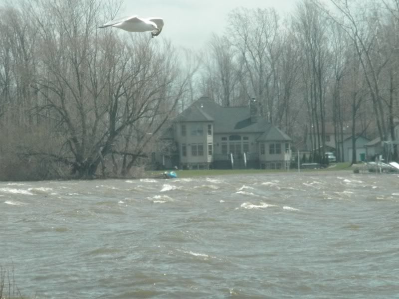
This is a very sketchy map of Lake Ontario near where I live in Greece. As you can see, there is a series of small ponds across from the larger mass of Lake Ontario. Actually, homes exist on the narrow white band right at the edge of the lake. I'm telling you that just to give you an idea of the lay of the land.
Find Cranberry Pond. This is what Cranberry Pond looks like on a day when the winds are blowing from the Southwest toward the Lake. Ontario, by the way,is calm as it can be at the same time Cranberry Lake looks like this:

Those would be white caps. I actually stayed in the car to take most of my pictures because I felt like I was blowing over when I ventured outside!
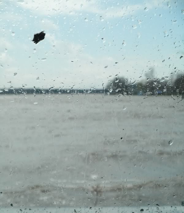
This is one of those ever so popular perspective shots. I am sitting inside my car, looking at the inside of the passenger side window. The car is at least twenty feet away from and six feet above the water. The water on the window has been carried by the wind off the tops of waves and slammed into my car.

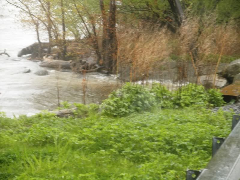
So, that's the pond - and the other ponds along that road were mirror images of Cranberry that day. I just had better parking on Cranberry so I decided to use it as an example.
Then, two weeks later, after more rain and more wind and then more rain, I woke hearing the same odd sound that I'd heard before I went to sleep the night before. No, it wasn't my evil twin Skippette asking for breakfast. I promise. She's not a big breakfast eater, anyway.
I couldn't figure the sound out. So, in typical "me" fashio, I got myself into my Monte C. and headed in the direction of the sound. Correction. Of the roaring sound.

The wind was a nor'easter, and the roar was the sound of Lake Ontario's waves crashing against the shore. I live about 3/4 of a mile as the sparrow flits from the shore of the lake: it's a bit longer by road.

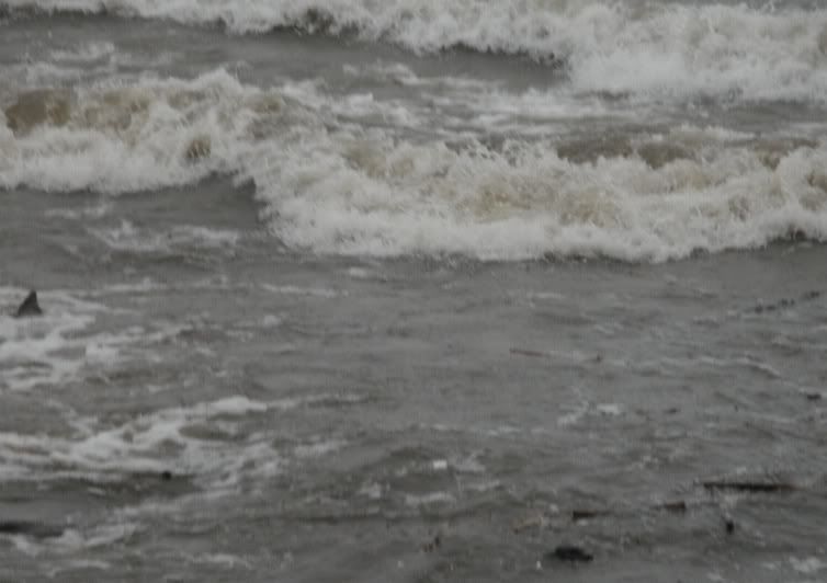
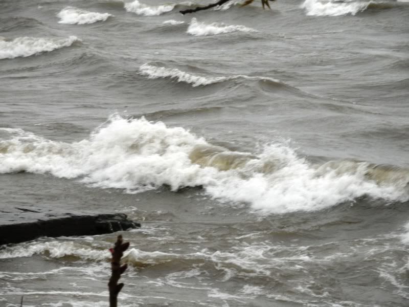
See the rock in the lower left? Again with the perspective giving. Oh - I didn't make the pictures greytone or anything. This is what the color of the world was like that day.

Here's a shot with a little green in it to relieve the greyish brown (taupe?). If you look out toward the horizon, you can see a line of swells that gives you (you guessed it. Sorry!) another perspective of how heavy the wave action was.
This is, by far, not the worst I've ever seen, but the roar of the waves came so clearly and the wind blew so strongly that I knew I wanted pictures to put out in a blog, if ever I decided to do such a thing.
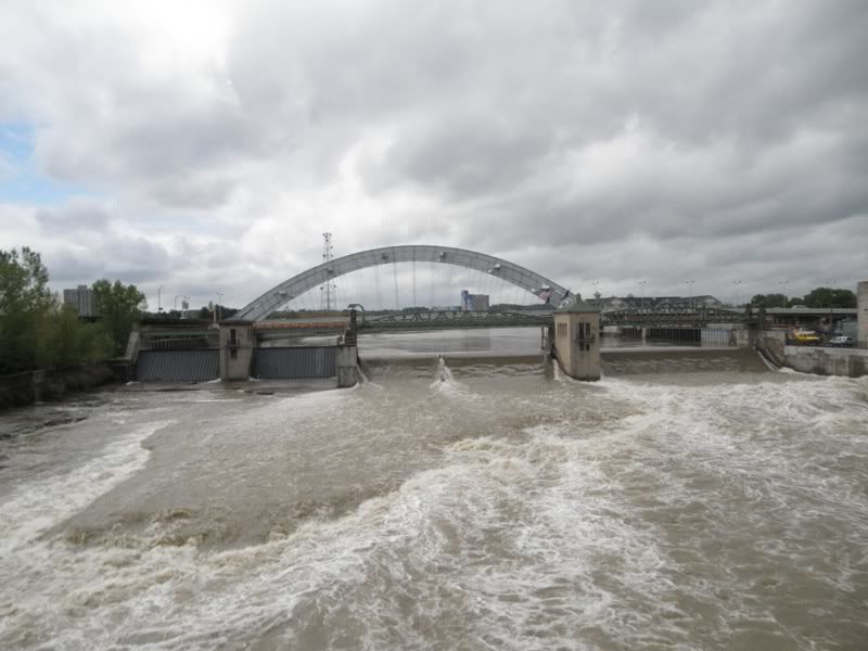
The Genesee River starts way down to the south of Rochester in the Southern Tier, more or less. It empties into Lake Ontario via Charlotte. And it runs straight through Rochester on its way. After days of rain and then a little more rain followed by a LOT more rain all around and over us, I knew that the Genesee would be raging on its way through town. So, camera in hand (wriststrap securely in place), I headed downtown.
I parked in the Court Street Ramp Garage, which has slots for library patrons, which I also intended to be, since I was right next to the main branch of the Monroe County Library System: Rundell Library. (Note to people moving to new places. Get a library card before anything else. At least, that's my philosophy!!!)
Now, oh goody, you get to look at a plaque:

Basically, the site where the Court Street Ramp Garage now sits was the place where, in 1886, George Eastman produced the first photographic film. The transparant film with its layers of coatings would revolutionize the art of picture taking, make moving pictures possible, and altered Rochester forever. Eastman Kodak (George Eastman made up the name Kodak. He wanted a name that would stick easily in peoples' minds. It worked) began in that small factory back then.
But I wasn't downtown to review Kodak, for which I worked for a quarter of a century (makes me sound ancient!!! Well, of course, I AM!!!). There are books out there to do that.
I was downtown to look at this:
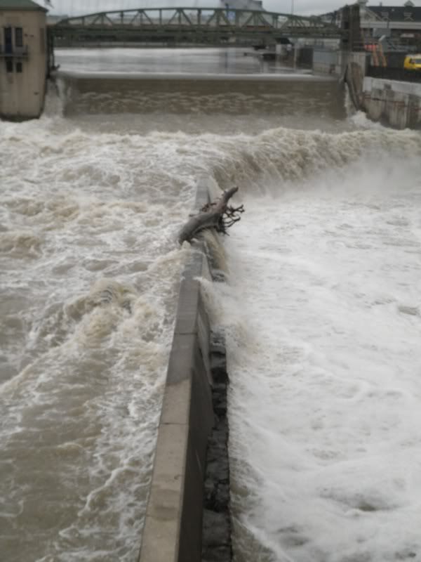
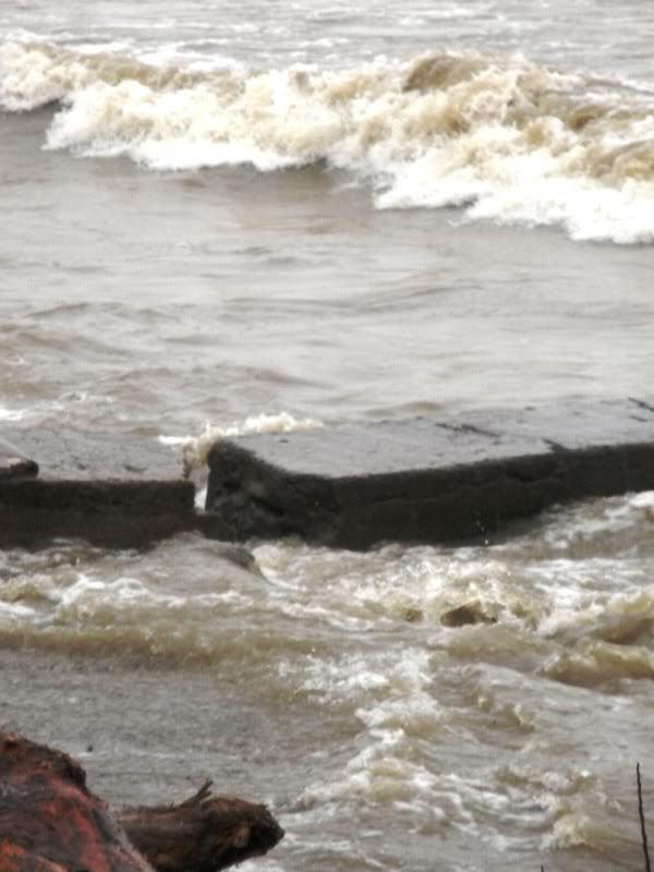
This is a shot to the left of the spillway in the previous picture. In the rough center of the picture is an area that seems to be smoother. It's a higher section of the river bed. The water is racing through on its way to Charlotte and it only looks quieter because of the smoothness of the bed.


I'm still standing on the Court Street Bridge, but have walked over to the other side and am shooting in the direction of the Broad Street Bridge. The large building at the right is the main branch of the library. Overflow from the river is draining down the bank.
The Broad Street Bridge has been named to the National Register of Historic Places, as has the Court Street Bridge. It was built from 1836-1842 and was originally an aqueduct that carried boats on the Erie Canal through the city. There were 3 other major aqueducts built in the 19th century to support the Erie Canal. Ours is 800 feet long from abutment to abutment.
In the 20th century, the aqueducts was paved to serve auto traffic. The lower level (those arches you see) were part of the short-lived Rochester subway.
I walked over to the Broad Street Bridge to look back at Court Street (they run parallel to each other).
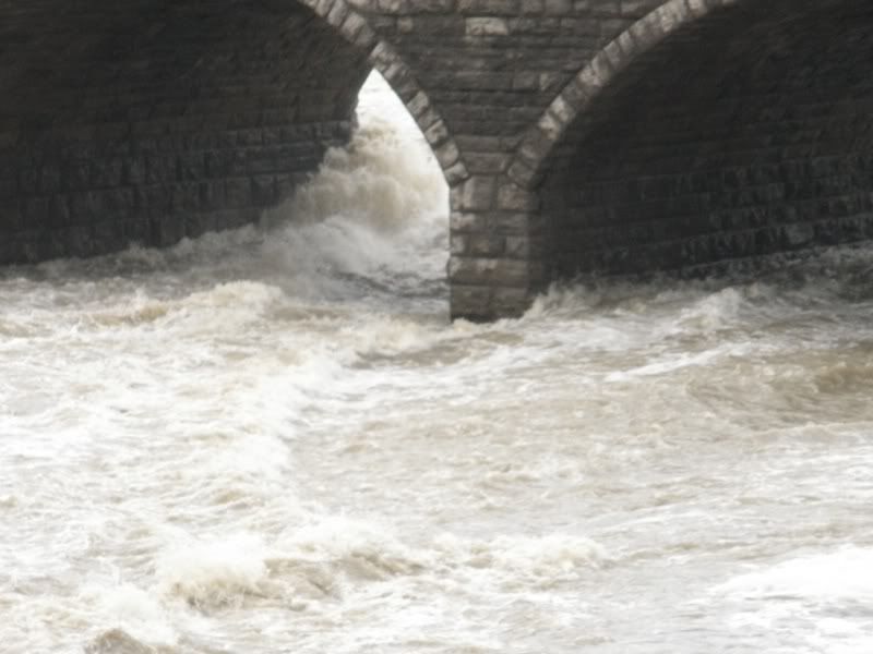
Here's the water tearing under one the arches that supports Court Street's bridge. I'm looking from a slightly greater height than I was on Court Street.

This gives a better idea of the difference in height. And shows again the power of this water as it crashes through Rochester.
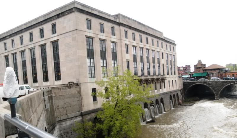
I grabbed a shot of Rundell so you'd have an idea of its size. The white thing at the lower left is a covered parking meter. Rochester has introduced kiosks where people buy time in parking spots. Note the charming blue sky? Er...grey. Yup, that would be our sky. Sigh...fortunately, things change fairly quickly (well, every ten days or so) around here.
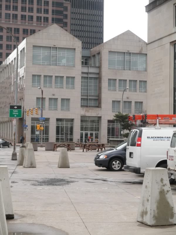
A decade or so ago, across from Rundel, this annex (3 stories plus a lower level and underground walkway to the main branch) was built, in large part to make it possible for the public to have ready access to more of the library's vast collection. Rundel is huge, but the vast percentage of its collection was stored in the "stacks" which were open only to libary employees. If a patron needed books from the stacks, they were fetched and brought to the main desk. Now the patrons can find books they need on their own. And there's room to expand! I love the older building - walking into it is like being there when I was younger. But the new building has helped our "we love books" population (and, oh MAN do we love books!) have even more of them right there under our fingertips. MOST excellent!
So, having taken the pictures I wanted of the water of the Genesee, and having wandered happily through the library for an hour, I decided to borrow 2 books (The Desert and the Sown by Gertrude Lowthian Bell (who was one incredible lady!), published originally in 1907 (the book I borrowed is from the 1928 third printing) and Roadside Geology of Maine which is a state with one HECK of a geologic history!)) and wended my way back home.
When I say I wander? Ya gotta believe I WANDER! Until next time!