
Tonight I'm going to do something rather indulgent for me. I'm going to show pictures of passes. As in passes over mountains. And, of course, the mountains themselves. I'm going to stick to passes that I have been on personally just as I've done with the rest of this a Westing Post...And, by default, we're going to do a lot of looking along the Continental Divide.
The Continental Divide is a very non-straight line that serves as a pivotal watershed divider. On the East side of the Divide, waters flow toward the Atlantic and the Gulf, the Great Lakes, all that East-y stuff, you know? On the West Side, the Pacific and the Baja Gulf are the destinations of choice. And, quite literally, there are places where an individual can stand with one foot on one side of the divide and the other foot on the other side. Which probably means something dire in terms of using the portapotty, but...I will not go there.
The Continental Divide, by the bye, is not confined to the mountains. Here's a picture of it along I-10 in Arizona
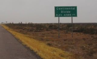
We're only at 4585 feet here, but the continental divide still exists. It's actually kind of neat, you know?
Passes are routes over mountains. They can be in a dip between two high spots on a mountain, along the flank of the mountain, or straight up the side of the mountain. And they can be either short or long: Monarch Pass has a 32 mile approach and departure. Guanella is something like 5 miles of steep hairpins...
The key thing to remember is that we can for the most part do the trip in a very short period of time. But when these passes were first mapped out, the time on a pass was measured in days for the most part.
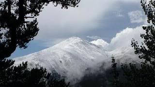
Here's a beauty: Wolf Creek Pass, in Colorado. The view is nice, but what people remember most about Wolf Creek is the snow. It's pretty:
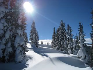
And it's plentiful. The average snowfall at Wolf Creek Pass is 465 inches. Yup, you read it right. 465 inches. And, ye who are skiers, most of that is powder.
Because there's enough snow to cause, oh, just a FEW little snowslides or avalanches, Wolf Creek Pass has things called snowslide sheds that protect the road (and drivers) from snowslides. The snow slides, but goes over the roof of the shed toward the valley below, well, there's a valley - by the middle of an average winter, you just can't see it. Here's a snowslide shed:
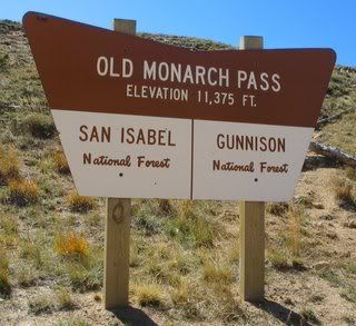
Let's see...oh yes: Monarch Pass, both Old Monarch and New Monarch (the New Road is slightly lower in elevation than the old road.
Here's the Summit Marker for Old Monarch Pass: 11,375 feet, which is one heck of a lot of feet, believe me.
A view from Old Monarch:
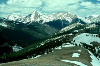
We are well above the tree line here. Whatever vegetation there is is tundra. (Some of the best examples of tundra vegetation are on the East Slope in Rocky Montain National Park near Estes Park. The vegetation is protected - it's possible to see it, but you need to keep on trails to avoid destroying it.
This picture was taken in early summer, I believe. Not a lot of snow (it DOES generally melt except in stubborn areas...). Which leads me to Independence Pass.
Independence Pass is closed during the winter, as in there's a gate across it and the Colorado Highway Department doesn't keep it plowed (mostly because there are other less...er...challenging? Yup, challenging passes to go over to get where you want to go. However, every effort is made by the Highway Department to have the pass open by Memorial Day (yeah, that day in May). This effort can (and often does) include dynamite. It goes without saying that, in my opinion, the crews that plow the high country are among the very best in the nation (if not the best, but I'm biased).
Here's what the snow looks like after the pass has been opened for Memorial Day:
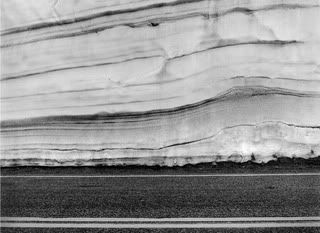
The double stripe is the highway. The snow goes up above the picture. This was Memorial Day 2008. Independence Pass is at 12,095 feet above sea level.
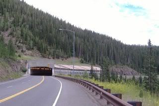
I'm going to spend a little time closer to Denver now - specifically at the Eisenhower Tunnel. The tunnel has been in operation since the 1970s and was built to allow safer travel than that which goes over Loveland Pass. Hazmat carrying vehicles still must use the pass, which is both steep, twisty and trecherous. I've been on it in the summer and in the winter (just a couple of times) and wouldn't recommend it unless you're driving in July or August.
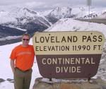
Here's Loveland Pass' elevation marker. I'm guessing that it's early Spring, since the person in the picture is in shirt sleeves.
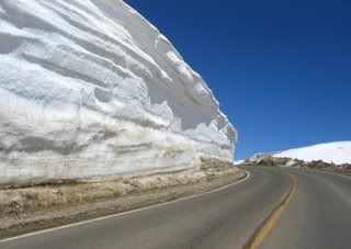
There are times during the winter when the snow is bad enough that the pass has to be closed. The haz mat trucks are then put through the tunnels (one bore going East and the other bore going west)...and, yup, there can be a lot of the white stuff:
The tunnel is on !-70 and is part of the daily commute (yup, you read that right) for hundreds of people who live in the mountains and work in Denver or Evergreen, places like that. In the winter the commute can be..er..."interesting". Yup...good word. Here's a picture of an accident on one of the approaches to the tunnel. I normally don't show things like this, but it's a roll over, which means you aren't going to see anything much because the car is over the side of the hill.
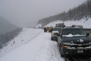
I'm guessing that the folks in the car made it out all right - this isn't a sharp drop off.
I learned really quickly that, like all things, winter is relative. Colorado has a lot of snow all at once, then gorgeous blue skies immediatelhy after the storms go, which means winter is beautiful. Rochester has some snow and grey days, which means other things. But I rarely complain about Rochester winters now. I've seen the real thing. (It was kinda cool, you know?)
Okay, now for some really pretty passes:
Boreas, which heads East up and behind Breckenridge, is a pass with a gentle climb and wonderful views:
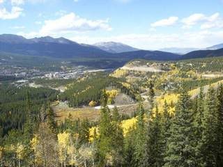
The autumn picture is from the summit of the pass looking back down the road and toward Breckenridge...
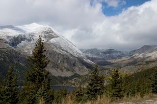
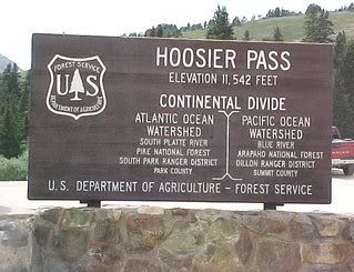
Hoosier Pass is South (and up) of Breckenridge and leads to Fairplay, Co and out down the East Slope: The second picture is its elevation marker.
I have this feeling that this post is almost too long to make it. I'm hoping I'm wrong, but I'm going to post it now just to see!
Remember, all, these are passes that I have travelled: I didn't include Fremont and a couple of others because of the size of this posting. But perhaps I shall continue tomorrow, because, heaven knows, cooking and breathing at high altitudes are incredible experiences...(smiles and then laughs raucously!!!). And you STILL haven't met George and Matha Driver!!!!
Off I go...let's see if this makes it!!!
No comments:
Post a Comment